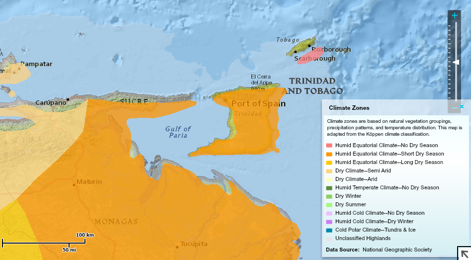
CLIMATE ZONES MAP All of Trinidad is mainly Humid Equatorial Climate- Meaning that they have Short Dry Season. And Tobago is all mainly Humid Equatorial Climate Meaning they have No Dry Season. They classify these climate zones based on their Natural Vegetation, And precipitation patterns.
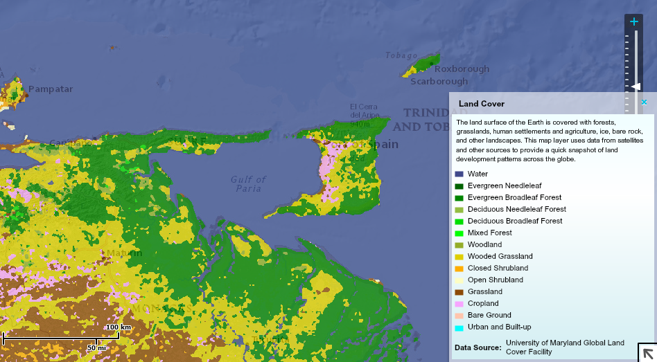
LAND COVER MAP This Map uses data from satellites and other sources to show the land development patterns across the world. As for Trinidad and Tobago, They are categorized into 4 different land covers, roughly 65% of Trinidad is Evergreen Broad-leaf Forest. 25% is Wooded Grassland, 8% is Cropland ,and lastly 2% is Grassland.
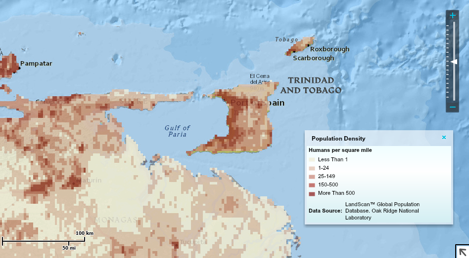
POPULATION DENSITY MAP The majority of the population lives on the west coast close to the capitol where almost all the cities are located. Then once you start getting towards the middle/East it starts to evenly distribute.
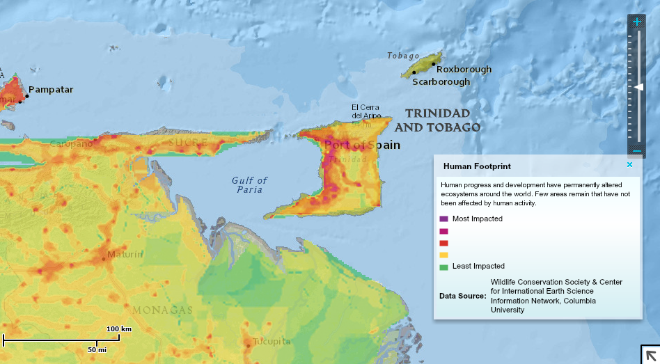
HUMAN EFFECTS This is a Human effects map showing the amount of impact Trinidadians Have had on their ecosystems and environment. As you can see the most impact is mostly in highly populated areas.
